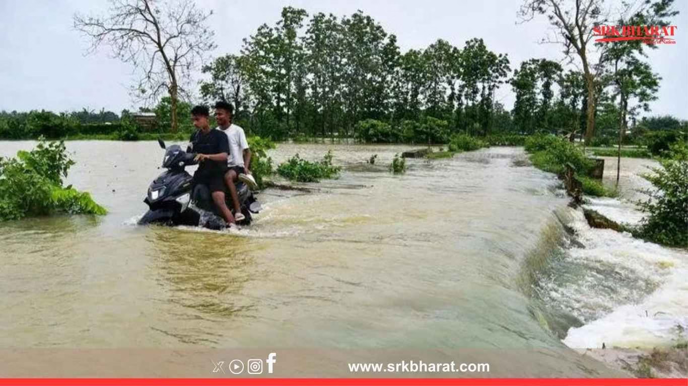
India’s Central Water Commission (CWC) has issued an alarming alert, flagging flood risk at 20 river sites across multiple states, with Assam and Bihar facing severe inundation threats amid incessant rainfall in upstream catchments. The warning comes at a critical juncture when large parts of northeastern India are already submerged, displacing lakhs and causing economic disruption.
Rivers Breaching Danger Levels Across India
According to the CWC’s daily flood situation report, as of Thursday morning, 20 river gauge stations have crossed danger or highest flood level marks, triggering red alerts in multiple districts.
| State | Rivers Under Flood Threat | Key Districts Affected |
|---|---|---|
| Assam | Brahmaputra, Kopili, Subansiri, Dhansiri, Beki | Lakhimpur, Dhemaji, Barpeta, Morigaon, Nalbari |
| Bihar | Gandak, Bagmati, Kosi, Mahananda | Sitamarhi, Muzaffarpur, Supaul, Katihar, Kishanganj |
| Uttar Pradesh | Ghaghra, Rapti | Gorakhpur, Siddharthnagar, Bahraich |
| West Bengal | Mahananda | Malda |
| Meghalaya | Simsang | East Garo Hills |
Current Situation In Assam
Assam is witnessing one of its worst flood spells in recent years, with the Brahmaputra river and its tributaries flowing above danger levels in at least 10 districts. The Assam State Disaster Management Authority (ASDMA) reported:
- Over 24 lakh people affected across 30 districts
- Floodwaters breaching embankments in Barpeta, Morigaon, and Nalbari
- Major roads and rail links disrupted in lower Assam
Chief Minister Himanta Biswa Sarma has been conducting aerial surveys and coordinating with NDRF and SDRF for rescue operations.
Impact On Kaziranga National Park
Kaziranga National Park authorities confirmed that 70% of the park area is submerged, forcing wildlife including rhinos, elephants, and deer to move towards highlands and adjacent highways, increasing the risk of road kills. Speed restrictions and patrolling have been intensified on NH-37 passing through the park.
Bihar’s Rising Flood Crisis
In Bihar, heavy rainfall in Nepal’s Terai region and north Bihar catchments has swollen the Bagmati, Gandak, Kosi, and Mahananda rivers, posing grave risks to embankments. The Water Resources Department stated that the Gandak barrage is witnessing high inflows, requiring close monitoring.
Key Effects In Bihar
- Low-lying villages in Sitamarhi, Supaul, and Muzaffarpur inundated
- Crops in thousands of hectares submerged
- Threat to weak embankments built decades ago, needing urgent strengthening
- Evacuation and temporary shelters activated in flood-prone districts
Why Are Floods Intensifying?
Experts attribute the worsening flood situation to a combination of:
- Excess rainfall patterns driven by climate change, causing sudden river swelling.
- Sedimentation in Himalayan rivers like Kosi and Gandak, reducing channel carrying capacity.
- Encroachment and degradation of natural floodplains hindering river flow and absorption.
- Embankment breaches and lack of maintenance exacerbating the inundation impact.
Statements From Officials
Central Water Commission
“We are issuing hourly advisories to state agencies and monitoring critical sites round the clock to ensure timely action.”
Assam CM Himanta Biswa Sarma
“The floods are severe this year. We are prioritising rescue, relief, and medical aid to affected people and livestock.”
Relief And Rescue Operations
| State | Rescue Measures |
|---|---|
| Assam | NDRF, SDRF, Army deployed for evacuation; over 50,000 people in relief camps |
| Bihar | District administrations evacuating people from vulnerable embankments; food and water supplies dispatched |
| UP | Disaster management teams on standby in eastern districts |
Forecast For The Coming Days
The India Meteorological Department (IMD) has predicted continued heavy rainfall over northeastern states and Bihar for the next 48-72 hours, raising further flood risk. CWC has advised state governments to remain on high alert for potential embankment breaches and urban flooding.
Long-Term Solutions Suggested By Experts
Flood management experts and river engineers have reiterated the need for:
- Reviving traditional floodplain management rather than exclusive reliance on embankments.
- Integrated basin-wide planning between Nepal and India to regulate transboundary river flows.
- Sediment management strategies to address siltation in Himalayan rivers.
- Strengthening and realignment of old embankments, which were designed for lower flood magnitudes decades ago.
- Improved flood forecasting models integrating real-time rainfall, catchment saturation, and dam releases.
Climate Change And Northeast India’s Flood Vulnerability
Multiple studies have indicated that Assam and Bihar remain among India’s top states vulnerable to climate-induced floods due to:
- Rising monsoon rainfall variability
- Himalayan glacier melt increasing river discharge unpredictability
- Lack of adequate urban drainage systems in expanding towns
Voices From The Ground
Purnima Devi Barman, Conservationist, Assam
“Floods are an annual reality, but their intensity is increasing. People and wildlife are equally impacted. We need ecologically sound flood management, not just embankments.”
Ravi Prasad, Farmer, Muzaffarpur
“We just finished planting paddy. Now the entire field is under water. We don’t know how we will recover this season.”
Government Action Plan Underway
The National Disaster Management Authority (NDMA) has activated inter-state coordination mechanisms, while the Ministry of Jal Shakti is assessing the situation for possible central assistance packages for flood-hit states.
Conclusion
The CWC’s latest alert over 20 flood-prone river sites across India, particularly Assam and Bihar, signals the urgent need for immediate rescue and relief measures as well as long-term climate-resilient flood management strategies. As rainfall continues unabated in the Himalayan catchments, effective coordination between state disaster agencies, central ministries, and communities remains the key to minimising the human, ecological, and economic toll.
Disclaimer: This news content is based on official statements from the Central Water Commission, state governments, and domain experts. It does not constitute flood management advice. Readers in flood-prone regions are advised to follow local administration warnings and evacuation orders for safety.


